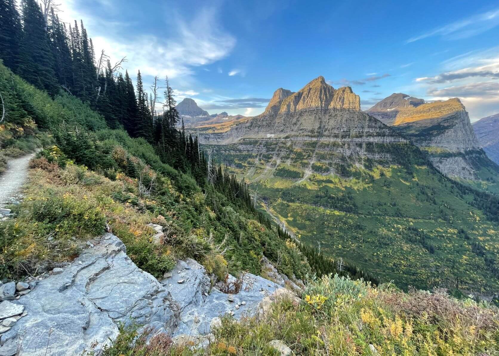
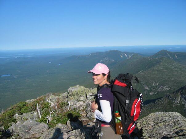
Mount Katahdin, known as “Greatest Mountain,” represented my first significant climb and, at the time, the most arduous hike I had encountered. This endeavor undoubtedly challenged my limits and initiated my passion for hiking and exploring mountainous terrains. With an elevation gain of approximately 4,000 feet and a one-way distance of 5.2 miles, this hike poses a considerable challenge—especially during the final leg for those traversing the Appalachian Trail northbound.
Preparation for the Summit
Successfully summiting Mount Katahdin necessitates thorough preparation. Reflecting on my experience, I recognize several aspects I could have addressed more effectively. For those contemplating their inaugural hike up this mountain, several factors require consideration and planning.
Accessing Mount Katahdin
Situated in northern Maine, Millinocket is the nearest town, located just 17 miles from the park, making it a convenient stop for any last-minute supplies. Many hikers opt to drive in, utilizing the various campgrounds spread across the 209,644 acres of parkland.
The main campgrounds include Roaring Brook, Abol, Chimney Pond, and Katahdin Stream Campground, where I stayed prior to hiking the Hunt Trail. There is a dedicated parking lot at Katahdin Stream Campground for those intending to use the Hunt Trail to reach the summit. If your plan is to engage in a day hike and not to camp, securing a parking reservation is advisable to guarantee a space upon arrival.
For campers, advance reservations are essential, whether for a tent or a lean-to. It’s important to note that there is a $14 non-resident fee per vehicle for entry into the park. Visitor numbers are strictly regulated, permitting only a limited quantity of daily admissions.
I strongly recommend camping, as the hike necessitates an early start to fully appreciate the experience. During my ascent, we commenced our trek around 3 AM, providing ample time to summit and return before nightfall. A headlamp is crucial for the initial hours of hiking, which are generally the easiest parts of the trail before advancing into the more challenging sections.
Weather Considerations
The mountain’s weather can be remarkably unpredictable. Severe weather may occur even during peak season in summer, and due to its remote location, rescue operations can be exceedingly difficult. During my climb, we encountered fellow hikers descending who had been stranded by unexpected snow and hail, despite it being August.
Fortunately, we enjoyed favorable conditions, but be aware that the summit and many points along the route are highly exposed. It’s essential to monitor weather updates in the camping area and adjust your plans accordingly. Expect an 8-12 hour hike, during which weather and temperatures can shift rapidly.
Essential Gear
Although Mount Katahdin may not be among the seven summits, it still poses significant challenges and demands preparation for a successful ascent.
Packing Suggestions
Strive to pack as lightly as possible. More experienced hikers may already understand the importance of minimizing weight, but I learned this the hard way, carrying an inadequate pack on my first attempt. Aim to equip yourself for success without exhausting your energy by overburdening yourself.

For further detailed recommendations, consult my packing list specific to hiking Mount Katahdin.
Nutrition and Hydration
The entire round-trip journey may take between 8 to 12 hours; thus, it’s vital to carry energy-dense foods and sufficient water to maintain hydration. Many trails feature limited water sources, necessitating adequate provisions for the entire hike.
Appropriate Clothing
Due to the unpredictable weather and the exposed nature of the trails, it’s advisable to bring a variety of clothing layers. While this may increase pack weight, temperatures at the summit can be significantly lower, particularly during the June to August climbing season, which is ideal.
Safety Considerations
While not ranked among the most formidable summits, Mount Katahdin still demands respect. The trail’s classification as “extremely strenuous” is well-justified, given the boulder fields and the potential to stray from established paths.
Carry a first-aid kit, which can be procured from various outdoor retailers like REI. Familiarize yourself with your limitations and adhere to trail blazes. Remain mindful during the hike to maintain awareness of your surroundings.
Minor Essentials
Don’t overlook smaller items like sunscreen and insect repellent, critical for protection against the well-known Maine mosquitos and black flies. Sunshine exposure on the open trails necessitates skin protection, so including a hat can be beneficial.
Intensity and Fitness Recommendations
My climb of Katahdin was accomplished without any prior conditioning. I embarked on this adventure impulsively, leading to serious aches and challenges along the way. To avoid suffering unnecessary hardships, it is advisable to undertake shorter hikes in your area prior to your Katahdin attempt.
If you frequent a gym, productive exercises include squats and stair climbing, even if they’re not the most enjoyable.
Katahdin entails a serious commitment. Depending on your path, the climb may cover approximately 3 miles with an average elevation gain of 4,000 feet, typically amidst exposed elements. Given the rugged, strenuous nature of the hike, one must approach this undertaking seriously to mitigate injury risks.
Trail Options

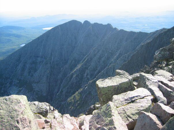
Baxter State Park encompasses 220 miles of trail, of which 16% are located on Katahdin. There are a total of nine trails that lead to the summit, including the Knife Edge Trail, which features steep drops on either side at the mountain’s highest point and may be intimidating for those prone to vertigo.
For my hike, I selected the Hunt Trail, renowned for its breathtaking views, covering 5.2 miles with an elevation gain of 4,188 feet. This path showcases diverse features, such as the steep boulder sections on Hunt Spur and the panoramic views from the Tableland, where 2.4 miles lies above the tree line.
If you’re seeking the quickest ascent, the Abol Trail is the best option at 4.4 miles (with one mile on the Hunt Trail) and an elevation gain of 3,982 feet. Although challenging, it remains manageable. For a gradual climb, consider the Saddle Trail, labeled more “strenuous” than the others, thus offering less difficulty.
Other trails include Helon Taylor, Dudley (temporarily closed), Cathedral, Hamlin Ridge, and Chimney Pond.

Conclusion
Upon arrival, ensure to visit the ranger’s station. This resource provides updated information on weather conditions and trail status—including wildlife sightings or closures. Such insights are vital for any hiking or climbing expedition. Rangers possess the most current area knowledge, surpassing any online information.
Regardless of the trail chosen, an unforgettable adventure awaits, complete with stunning vistas and a formidable challenge. Which trail did you select? What would you recommend? For additional insights, refer to my guide on hiking Mount Katahdin.